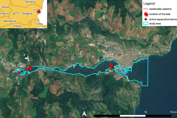
The investigation by Watershed Investigations and Investigate Europe centred on a continent-wide effort to map Europe and the UK’s landfills and waste sites, revealing how many sit in locations highly vulnerable to flooding, erosion, groundwater contamination, and ecological damage. With no comprehensive EU-level database and fragmented national records, the project compiles open-source datasets and country-level disclosures to build the first large-scale picture of landfill risk.
Early results show tens of thousands of sites in hazard zones, including drinking-water catchments, protected landscapes, coastal erosion belts, and regions with already-degraded groundwater, underscoring a vast, largely unmonitored pollution threat.
The data mapped by journalists suggests tens of thousands of landfills sit in areas exposed to flooding, coastal change, groundwater vulnerability, or ecological sensitivity. Climate change adds further pressure: floods could release chemicals from dumpsites, posing threats to ecosystems